
SERVICEEDGE SOLUTIONS
Transportation Planning
Planning Support From Web Applications, Raw Data to Maps, Models & Deliverables
ServiceEdge Solutions personnel have supported the development and execution of Long Range Transportation Plans (LRTP) and Transportation Improvement Plans (TIP), including survey-data processing, model support, reporting, mapping, and project-data tools.
TRANSPORTATION PLANNING
Support for Long-Range and Programmed Transportation Decisions
ServiceEdge professionals process transportation planning data and model outputs into usable analysis, reports, maps, information portals, and project-management tools.
Long Range Transportation Plans
Support LRTP development through information portals, survey data processing, Cube Voyager scripting, origin-destination mapping, and model network conflation.
Transportation Improvement Plans
Support TIP workflows through information portals and project data management tools.
Survey & Model Data Processing
Process on-board bus surveys, cordon-line travel surveys, highway-speed surveys, and LRTP model output into reports and map products.
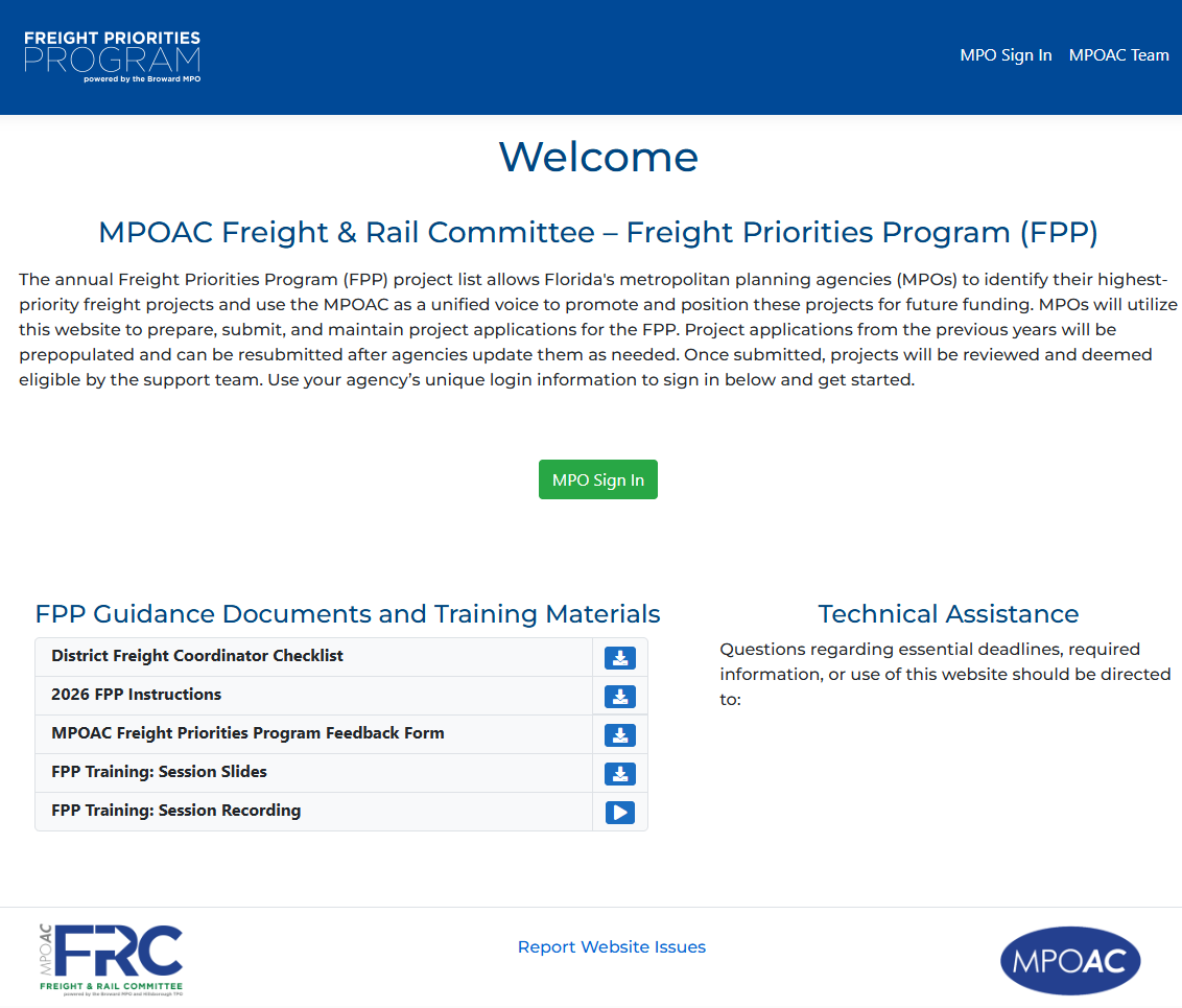
From Planning Data to Decision-Ready Products
Transportation planning projects often bring together large volumes of survey, model, network, and project information. ServiceEdge supports the processing and organization of these data into products that planners and decision-makers can use.
Our existing transportation planning work includes LRTP and TIP support as well as mapping, portals, scripting, model-network processing, and project-data management.
LONG RANGE TRANSPORTATION PLANS
Technical Support for LRTP Data, Models & Communication
ServiceEdge has supported LRTP workflows that combine survey information, travel-model data, network processing, mapping, and information delivery.
Information Portals
Organize and communicate transportation planning information through accessible project information tools.
Survey Data Processing
Process on-board bus surveys, cordon-line travel surveys, and highway-speed surveys for planning use.
Cube Voyager Scripting
Support transportation model workflows using Cube Voyager scripting.
Origin-Destination Mapping
Convert travel survey and model information into origin-destination map products.
Model Network Conflation
Support model-network processing and conflation for planning applications.
Reports & Map Products
Transform LRTP model output and analysis data into reports and mapping products.
TRANSPORTATION IMPROVEMENT PLANS
Organize Project Information for TIP Workflows
For Transportation Improvement Plans, ServiceEdge supports information delivery and project-data management so planning information can be organized and maintained efficiently.
Information Portals
Develop and support information portals used to organize and communicate TIP-related information.
Project Data Management Tools
Support tools and workflows for organizing and managing transportation project information used in TIP development and maintenance.
RELATED SERVICEEDGE CAPABILITIES
Connect Planning With Transit, GIS & Software
Transportation planning projects often benefit from the same GIS, data, application-development, and transit-planning expertise used throughout ServiceEdge projects.
Transit Planning
Connect transportation planning with GTFS, ridership, service planning, operational analysis, accessibility, and transit performance workflows.
Application Development
Develop flexible software and project-data tools that support specialized planning workflows.
GIS & Mapping
Transform model, survey, network, and project information into clear spatial analysis and map products.
Need Transportation Planning Support?
Talk with ServiceEdge about LRTP or TIP data processing, model support, mapping, information portals, or project-data management needs.