
SERVICEEDGE SOLUTIONS
Software Engineering | GIS & Spatial Technology | AI-Accelerated Development
Transportation expertise engineered into practical technology.
ServiceEdge Solutions designs software and geospatial systems for organizations that need more than an off-the-shelf application. We combine transportation-domain knowledge, GIS, databases, APIs, analytics, modeling, and intelligent automation to turn complex workflows into tools people can actually use.
Software Engineering • GIS & Spatial Systems • Data Integration • AI-Acceleration
ENGINEERING AROUND THE WORK
Technology That Understands Transportation
Transportation systems combine spatial networks, schedules, land use, demographic data, operational records, models, regulatory requirements, and reporting workflows. ServiceEdge builds technology around that reality. Our role is to connect those pieces into reliable applications that reduce manual processing, preserve technical rigor, and make complex analysis easier to operate and maintain.
Software Engineering
Custom desktop, web, service, and integration software designed around agency workflows, data, security requirements, and long-term maintainability.
GIS & Spatial Computing
Map-centric applications that combine network editing, spatial analysis, geoprocessing, visualization, geodatabases, and enterprise GIS services.
Data & API Integration
Connect transportation, demographic, land-use, operational, model, and enterprise data through managed databases, APIs, repeatable import/export workflows, and validation.
AI-Enabled Automation
AI-assists the software engineering process to accelerate the design, implementation, testing, modernization, and maintenance of transportation applications.
PROOF IN PRODUCTION
TBEST: A GIS-Based Planning System Built for FDOT
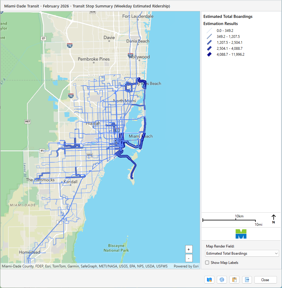
Through projects funded by the Florida Department of Transportation Public Transit Office, ServiceEdge professionals developed the Transit Boardings Estimation and Simulation Tool (TBEST) with research support from the Center for Urban Transportation Research.
From an engineering perspective, TBEST is much more than a forecasting model. It is a long-lived GIS-based planning environment that brings together transit networks, GTFS, socioeconomic and land-use information, ridership data, accessibility analysis, performance measures, scenario management, maps, and reports in one operational desktop application.
That work demonstrates our ability to translate specialized transportation methods into software that must remain understandable, extensible, supportable, and useful across many agencies and planning contexts.
WHAT THAT DEVELOPMENT EXPERIENCE MEANS
Complex Systems Made Usable
TBEST required software engineering, GIS, modeling, data management, reporting, extensibility, and long-term product support to work as one system.
Spatial Data Integration
Combine networks, points, polygons, demographic data, land use, service data, and model outputs within a consistent geospatial framework.
Transportation Modeling
Convert planning methodology into repeatable analytical workflows with configurable assumptions, scenario management, validation, and model outputs.
Operational User Experience
Hide unnecessary technical complexity behind workflows that transportation professionals can understand, review, and repeat.
Reporting & Visualization
Turn large analytical results into maps, summaries, tables, comparisons, and outputs that can support planning decisions and communication.
Extensible Architecture
Support custom Add-Ins, scripting, model packages, data updates, and evolving analytical needs without rebuilding the entire system.
Long-Term Evolution
Maintain and modernize a production application as operating systems, GIS platforms, data standards, and agency requirements change.
FROM APPLICATION TO PLATFORM
TBEST Pro: Managing the Full Software Lifecycle
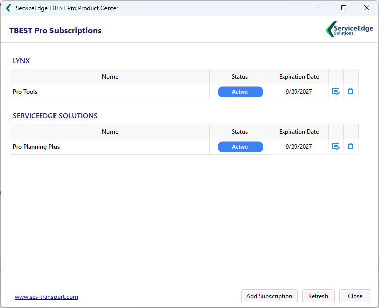
ServiceEdge extended its TBEST development experience into the TBEST Pro platform—a managed environment for delivering professional applications, ridership models, data packages, updates, and customer-specific extensions.
The platform combines a locally installed management application with API-driven licensing and subscription services. It can authorize products by organization and licensed service area, deliver and update software and model packages, connect users to hosted TBEST data, and support private customer deployments.
Technically, that means ServiceEdge is not only building individual tools. We are engineering the surrounding infrastructure required to license, distribute, update, secure, and support those tools throughout their useful life.
AI-ACCELERATED SOFTWARE ENGINEERING
Build Faster Without Sacrificing Engineering Discipline
ServiceEdge incorporates AI-assisted software engineering into our development process to accelerate the design, implementation, testing, modernization, and maintenance of transportation applications.
Tools such as OpenAI Codex and Claude help our developers move more quickly through time-intensive engineering tasks while ServiceEdge retains direct control over software architecture, technical decisions, testing, quality assurance, and final implementation.
AI AS AN ENGINEERING MULTIPLIER
ServiceEdge does not view AI as a replacement for experienced software developers or transportation professionals. We use it as an engineering multiplier.
Our developers define the architecture, business rules, data structures, GIS workflows, security requirements, and transportation logic. AI-assisted development helps execute well-defined engineering work faster, allowing more effort to be focused on system design, user experience, integration, testing, and solving the transportation problem itself.
This approach is particularly valuable for complex systems such as TBEST and the ServiceEdge TBEST Pro platform, where mature codebases, GIS technologies, databases, transportation models, APIs, deployment systems, and user-facing applications must all work together reliably.
TECHNOLOGY THAT FITS THE ENTERPRISE
Modern Engineering Without Losing Sight of Maintainability
We select technologies based on the client environment, integration requirements, deployment model, data volume, maintainability, and expected product life—not because a technology is fashionable.
Microsoft .NET / C#
Desktop, web and service applications with strong Windows integration, modern asynchronous processing, deployment, and long-term maintainability.
Esri + Geospatial
ArcGIS-based mapping, spatial analysis, geodatabases, web GIS, geometry processing, visualization, and GIS interoperability.
APIs + Data Systems
REST services, SQL/SQLite databases, managed data pipelines, file and enterprise-system integration, and transportation data standards.
AI Integration
Model/API integration and AI-assisted workflows designed around domain rules, source-data traceability, security, and human review.
HOW WE BUILD
Start With the Workflow. Engineer the Right System Around It.
1. Understand
Define the operational problem, users, data, decisions, constraints, and measurable outcomes.
2. Architect
Select the application, data, GIS, API, deployment, and security architecture appropriate to the environment.
3. Build
Develop the software and integrations iteratively, keeping the workflow visible to subject-matter experts.
4. Validate
Test against real data and real operating scenarios, including edge cases, performance, and usability.
5. Deploy + Support
Package, document, deploy, maintain, and evolve the solution as technology and client needs change.
Transit Planning
Apply transit operations, GIS, modeling, performance, and service data to planning and analysis.
Transportation Planning
Support LRTP, TIP, survey, model-output, mapping, and transportation project-data workflows.
TBEST Pro Solutions
Professional GTFS applications, ridership models, data services, managed deployment, and support built around TBEST.
Have a Workflow That Existing Software Does Not Fit?
Bring us the transportation, GIS, data, or automation challenge. We can help determine whether the right answer is a focused application, an integration, a geospatial workflow, an AI-enabled tool, or a larger software platform.