The ServiceEdge Transit Pro Tools provide a suite of specialized transit-supportive applications designed to address common challenges faced by transit planners, analysts, and data managers. Developed in collaboration with industry practitioners, the tools respond to real-world operational and analytical needs and support complete workflows from data input to final publication.
The Transit Pro Tools are packaged within a single TBEST Add-In, and are designed for use by transit agencies and planning organizations throughout the United States and internationally.
Transit Pro Tools currently support the following applications:
Matches GTFS route alignments to the OpenStreetMap (OSM) roadway network geometry. Produces improved GTFS route accuracy for map production and analysis.
Calculates National Transit Database (NTD) Directional Route Miles using GTFS and OpenStreetMap data, providing a streamlined workflow for developing and reviewing DRM statistics.
Compare existing and proposed GTFS datasets to identify route access sign changes at physical bus stop locations.
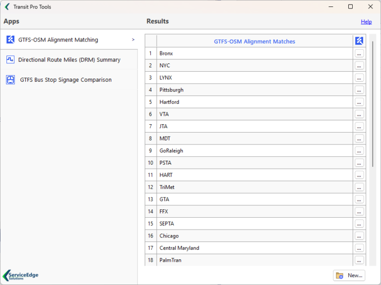
Transit Pro Tools - Results Manager
GTFS-OSM Alignment Matching
Transit agencies produce and publish static General Transit Feed Specification (GTFS) feeds to support internal and external transit trip planners, service planners, and app developers. One common issue with published GTFS files is the accuracy of alignment definitions within shapes.txt. This often includes misaligned segments relative to the road network and inconsistency across route patterns traversing the same roadway or rail segments. This situation can cause issues for GTFS consumers who rely on accurate network alignments for distance, revenue miles, revenue hours and directional route miles calculations. This issue also presents when producing route maps using GIS software.
The ServiceEdge Solutions GTFS-OSM Alignment Matching app matches GTFS route alignments to OpenStreetMap (OSM) roadway and rail networks. The matching process is an advanced, multi-step technique to address common GTFS alignment issues produced from industry-standard transit operations software. Not all GTFS alignments are “matchable” relative to OSM network geometry; however, the app will seam together on-network and off-network stretches to create a continuous route pattern geometry.
Matched GTFS results can used for external and/or internal publication.
Features
Match alignments for any transit agency within the US or internationally.
Replaces input GTFS alignments within shapes.txt with matched route alignments
Creates an ArcGIS Pro project file (.aprx) containing the matched route patterns, original route patterns and a set of generated Network Helper map layers which allow the user to evaluate the matching results.
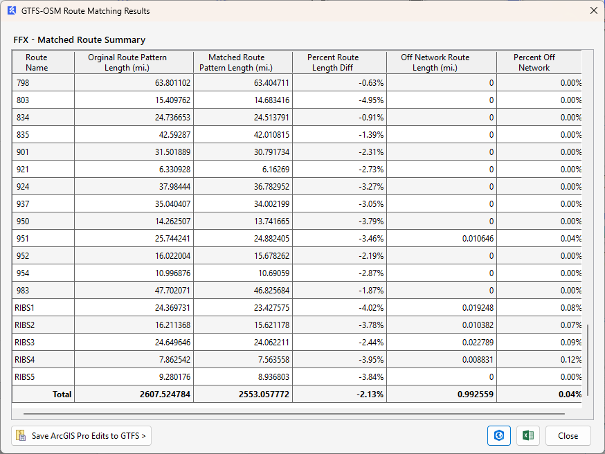
Evaluate results through a GTFS-OSM route-level matching report
Supports editing the original or matched GTFS alignments within ArcGIS Pro. Edits made in Pro can be saved back to the GTFS.
Modifiable Networking Parameters to fit matching algorithm to local GTFS alignment issues.
Manage App output via the Transit Pro Tools Results Manager.
GTFS-OSM Matching Results
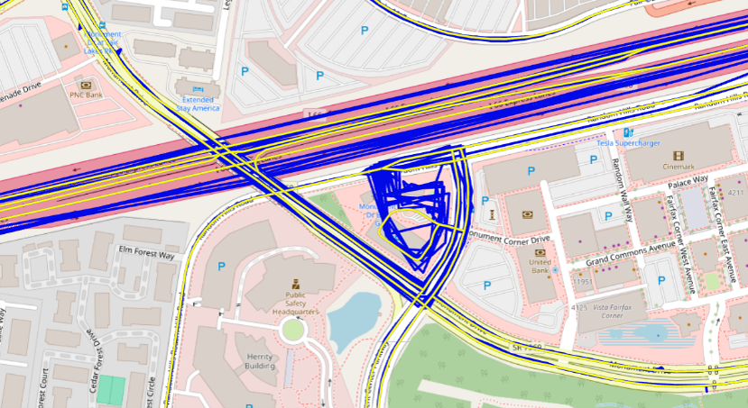
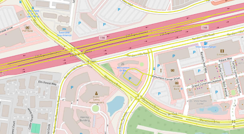
GTFS-OSM Matching Results
GTFS alignments in blue, matched alignments in yellow
Matched alignments only
NTD Directional Route Miles (DRM) Summary
Transit agencies subject to Federal Transit Administration (FTA) National Transit Database (NTD) reporting requirements may be required to report Directional Route Miles (DRM) for applicable fixed-route and rail services by NTD Mode and Type of Service. DRM represents the mileage in each direction over which public transportation vehicles travel while in revenue service.
Manually calculating DRM can require extensive GIS analysis to identify unique directional travel across roadway and rail network segments. For agencies operating multiple routes over shared facilities, this process can be time-consuming and susceptible to inconsistencies or double counting.
The SES Transit Pro Directional Route Miles Summary app streamlines this process using an advanced GTFS-to-OpenStreetMap (OSM) route-matching workflow with minimal user setup. Users provide their GTFS dataset, assign the appropriate NTD Mode and Type of Service to each route, and establish processing priorities for Mode and Type of Service combinations to help prevent overlapping mileage from being counted more than once.
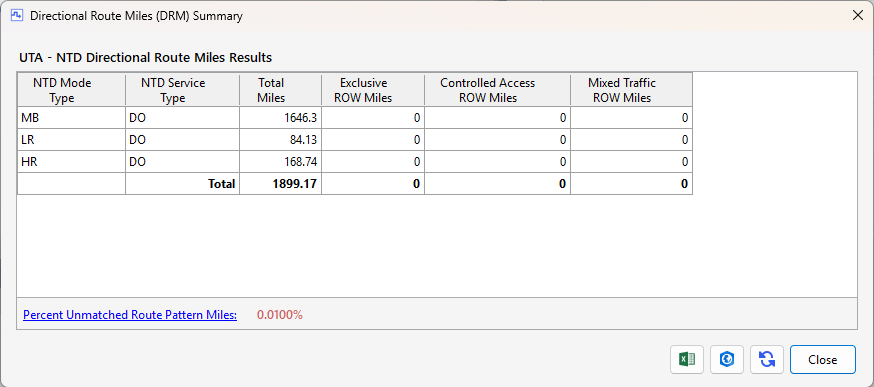
The app calculates Directional Route Miles for each applicable NTD Mode and Type of Service combination and produces a summary report designed to support NTD DRM reporting workflows. Calculated route alignments and DRM results can also be reviewed and edited in ArcGIS Pro, allowing agency staff to evaluate and refine results prior to reporting.
Features
Supports GTFS input for any transit agency within the US or internationally.
Summarizes Directional Route Miles by NTD Mode and Service Type.
Produces a mobile geodatabase containing a Segments feature class with unique directional Segments. The Segments feature class relates to a DRM summary table containing records for each route pattern traversing each segment.
Supports editing within ArcGIS Pro:
Set turn lane exclusions
Specify exclusive ROW segments
Specify controlled access ROW segments
Specify mixed traffic ROW segments
Exclude segments overlapping neighboring agency service
Manage App output via the Transit Pro Tools Results Manager.
Calculated NTD Directional Route Miles Report
Calculated NTD Directional Route Miles Report
GTFS Bus Stop Signage Comparison
Transit agency service changes often include modifications to the routes serving individual bus stops. Identifying these changes and determining where bus stop signage must be updated can be a time-consuming process.
The GTFS Bus Stop Signage Comparison app seamlessly compares a current GTFS dataset with a proposed service-change GTFS dataset to identify stops where signage updates may be required. The results include all existing and proposed service-change stops, indicate which stops require sign changes, and identify the routes serving each stop.
Results are provided in an easy-to-review CSV file, giving agency staff a clear and efficient way to identify and manage bus stop signage changes associated with service updates.
Features
Supports GTFS input for any transit agency within the US or internationally.
Identifies bus stop sign changes resulting from a agency service change.
Identifies removed stops, new stops, stops with no change and stops with route access changes.
Lists routes to be displayed on bus stop signs.
Manage App output via the Transit Pro Tools Results Manager.